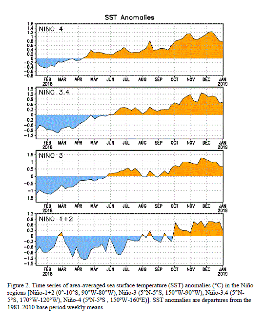
The sharp turn for the warmer in the Pacific is continuing. Last week we saw a dramatic difference between the resurrected La Nina at the beginning of the year:
Versus last week:
And finally today's update:
Zones 3 and 1 + 2 are in positive territory; 3.4 (where the official ENSO index is measured) is still negative, but only just. The anomaly, at -0.4C, puts us back in ENSO neutral territory. This calls to mind what I said when it looked like we were headed for a double-dip La Nina:
Right now there have been three overlapping three-month rolling averages that show La Nina conditions (3.4 anomaly < -0.5C):
If you ask the question of how many times the same phase repeated after making it all the way back to baseline (reaching or crossing 0.0C from either direction), and didn't have a weak alternate-phase episode that missed counting as such because it was not quite long enough or not quite intense enough, and then went back into the same phase, the answer is: it's only happened twice in sixty years, out of thirty-five transitions. So what they're projecting will happen would be pretty atypical.
. . . [But] while another La Nina episode is forecast, it hasn't happened yet. If it turns out to be too weak to meet the five-seasons cutoff, then goes into an El Nino, then there will have been nothing odd about it at all.
We have 2 months to go to meet the definition of a double-dip: December-January-February, and January-February-March. I doubt the former will shoot above -0.5C; it's already the end of February, and we will have had maybe a week or two total (in three months) above that mark. January-February-March, then, is ground zero for whether we end up with back-to-back La Ninas, or the oscillation gets another chance to live up to its name.


I love your blog. Keep up the good work. great job Thanks for sharing this valuable information with us.
ReplyDeleteac duct cleaning Hillsboro Beach fl